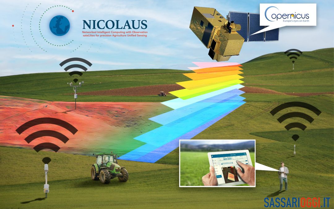
In the previous article, we told you about how the agricultural sector is benefiting from new technologies and, therefore, is constantly evolving. Today we will tell you about a concrete example of precision agriculture, which brings the world of the Internet of Things closer to the world of agriculture: the Nicolaus project.
As we have already mentioned, in recent years, agriculture 4.0, that is, the evolution of traditional agricultural techniques in favor of the use of technologies for land monitoring, is an increasingly common practice.
In fact, a growing number of farmers, eager to increase the productivity of their crops and become more sustainable, are implementing precision agriculture 4.0 systems.
Precision agriculture, in fact, uses technology for the precise acquisition of environmental and spatial data so that decisions can be made aimed at optimizing agronomic practices.
In this context, Nicolaus, a research and development project that is part of the Aerospace program, funded by Sardegna Ricerche with funds from the 2014-2020 Sardinia POR FESR and with Abinsula as lead partner and manager, was born.
Let’s take a quick look at what this is all about!
Nicolaus is a platform, aimed primarily at farmers and agronomists, that communicates data relevant to land management.
In fact, being a DSS (Decision Support System) tool, Nicolaus supports decisions regarding crop management, in full environmental support.
The information provided can indicate, for example, when is the most appropriate time to sow, irrigate and fertilize a given portion of land, thus avoiding unnecessary waste or the use of pesticides and plant protection products.
This is made possible through the assimilation of a series of data that are integrated with each other: ground sensors, climatic and satellite data enable the acquisition of a great deal of information useful to the agronomist in improving the performance of his or her farm.
Beyond simple data collection, the crux of such a project is the creation of knowledge and information, with the aim of providing useful communications and a complete picture of the observed farmland.
Let us now look more specifically at what the project consists of.
Nicolaus involves a platform that processes a whole series of data, obtained through a system of proximal and remote sensing, and presents them in the form of qualitative tabular data, vector and raster information maps and reports, which will then be made available to the user within an interface in which one has free access.
Project partners include:
- Abinsula, major representative and responsible for managing the front-end of the Nicolaus portal;
- the Department of Agriculture of the University of Sassari, responsible for the scientific and agronomic contribution;
- CRS4, Sardinia’s premier research organization, which processed the satellite and meteorological data.
For the acquisition of satellite images, Nicolaus relies on the Copernicus system, which is the European Earth observation program that uses large amounts of data from satellites to provide useful information to improve the quality of life of European citizens.
Let us now look more specifically at what benefits Nicolaus can offer.
Through the combination of new sensing technologies and a decision support tool (DSS) embedded in the Nicolaus platform, crops can be monitored remotely and effectively, so that anomalies can be detected more quickly and future agricultural activities can be planned effectively.
Other benefits due to the implementation of these technologies within farms are:
- lowering of final production costs;
- a high standard of product quality and quantity is ensured;
- carbon emissions are reduced;
- constant decision support is ensured.
In conclusion, thanks to precision agriculture projects such as Nicolaus, farms are able to compete in a new agricultural market, where sustainability is taken into account and where they raise the quality and quantity standards of the final product.
Sources:

